

Another hint in this very deed is the name Abercrombie. I knew who that was. I've run across him before. Stark lived in an area with a grouping of my ancestors on the south side of the Rocky River.
I am referring to John as "The First" because he lived in Anson County decades before Stark Ramsey's son John was born.
| Name: | John Ramsey |
|---|---|
| Home in 1790 (City, County, State): | Anson, North Carolina |
| Free White Persons - Males - Under 16: | 1 |
| Free White Persons - Males - 16 and over: | 3 |
| Free White Persons - Females: | 2 |
| Number of Household Members: | 6 |
In 1790, two John Ramsey's actually show up in the Anson County census. This first John Ramsey has a household of 6, Three males over 16, one under, and 2 females in the household, which doesn't tell us a great deal. He was enumerated near Edward Winfield, Drury Robertson and Richard Meanly, who are in my family tree, and which does give me a bit of information. These three all came from Southside Virginia and are related to me through my Winfied/Davis/Freeman lines.
| Name: | John Ramsey |
|---|---|
| Home in 1790 (City, County, State): | Anson, North Carolina |
| Free White Persons - Males - Under 16: | 2 |
| Free White Persons - Males - 16 and over: | 2 |
| Free White Persons - Females: | 2 |
| Number of Household Members: | 6 |
The other John Ramsey entry has him right next to Phillip Lynch and near Caleb Aldridge. Phillip Lynch was a next door neighbor of whom else, but old Uncle Edward Winfield, esquire. Caleb Aldridge Sr. was also a 5th Great Grandfather of mine. Phillip Lynch also comes into play in my Davis research. This John Ramsey also has six people, 4 males and 2 females. The only difference is that there are two under 16 instead of one.

This page was enumerated by Guilford Dudley. The first one was also covered by Mr. Guilford Dudley, so they were in the same district. It is my belief that this was one and the same family. I've seen this happen several times. Some people were enumerated twice, others were left out entirely on some cenuses. There must have been one teenaged boy who was not quite 16 the first time Mr. Dudley wandered through and by the time Dudley wandered through again, he had turned 16.
There are a couple of facts that add to the mystery of John Ramsey.
1) He only appears in the 1790 census.
2) He does not appear in the 1800 census, although Stark's 1803 Land Grant mentions that his grant borders the property of John Ramsey.
3) Stark Ramsey is the only Ramsey in the 1815 Tax Listing of Anson County.
4) Only Stark appears in the 1800, 1810, and 1820 census records of Anson County. Only Stark and his sons appear in 1830 and 1840.

Land records:
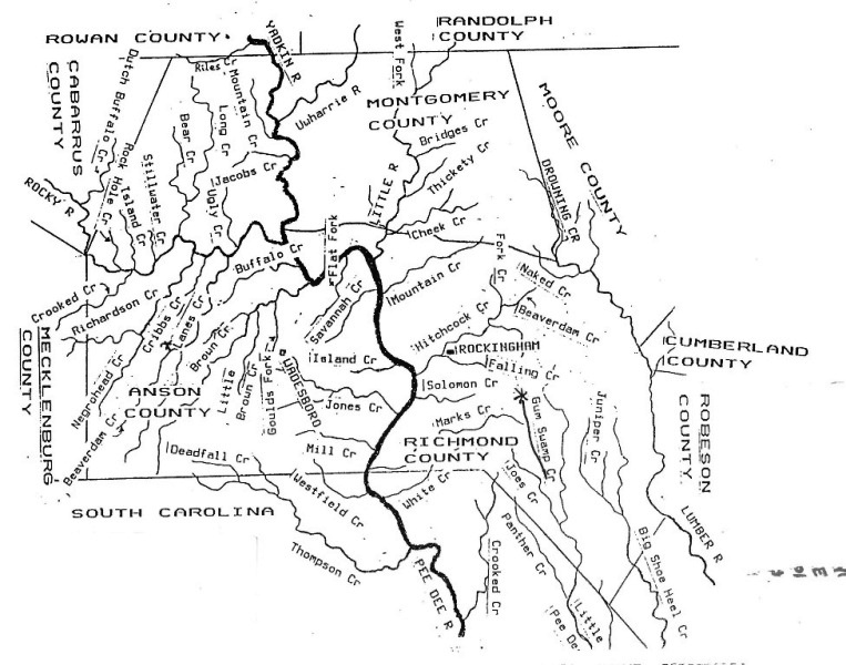
In the old Anson land records involving Stark Ramsey, it mentions "Spencer's Path". It also mentions among his neighbors, "Verhine", Isaac Ambercrombie, Broadway and Edward Winfield. Edward Winfield is a 6th Great Uncle of mine. Researching the Davis and Winfield families, I became a little familiar with the area in which they, and Stark Ramsey, lived.
Peter Winfield, father of Edward, arrived in Anson from Mecklenburg County, Virgina about 1784. He was married to Charlotte Freeman, daughter of Arthur Freeman and Agnes Stokes. They did not traverl alone. With them were Drury Robinson and his sons Drury Jr. and James, who had married nieces of Peter Winfield, Richard Meanly, who had married Charlotte's sister Keziah, and several others of Charlotte's Freeman and Stokes relatives, including her brother Henry. Several of the younger generation, including Drury Sr's sons and Peter's nephews Joel and John Winfield would later move to Marlboro County, SC. Several other members of the party, including Richard Meanly and his children, would move with Howells, Hogan's, Ropers, Randalls and Kendalls, their Anson neighbors, to Tennessee. Peter had bought his land in Anson from Hugh Ross, who also orginatied from the same area of Virginia. Seeing these names repeated helps put things into perspective.

April 7, 1787 Hugh Ross Sr., taylor from Anson to Peter Winfield of Anson, 200 acres on south side of Rocky river of Pee Dee River, begins at John Spencer's third corner hickory........joins Hogan & Preslar. Signed Hugh Ross; Witnesses John Lilly, Richard Randle and Donald Ross.
John Lilly also witnessed a deed with Starky Ramsey. The Spencer's path mentioned in Stark's record was a path, no doubt used by John Spencer.
1786 Deed from Richard Yarbrough to Richard Meanly, 200 acres on the South Side of Lane's creek, begins at Robert Lee deceased's corner red oak....Humphrey Yarbrough's old survey, and joins John Ramsey's beginning. (signed Richard Yarbrough: witness Daniel Young, William Davenport & "Namling" Freeman Manly 1787. This was Hamlin Freeman Manly, one of the Freeman- Manly (Meanley) relatives and a nephew of Charlotte Freeman Winfield.
Sept 19, 1788 Joshua Davis and wife Hannah of Anson to James Marshall of Anson, 65 acres on the south side of Rocky River, begins at the upper corner of the plantation near the mouth of a small branch beginning at a corner of an old grant and above the mouth of the spring branch. Signed Joshua Davis and Hannah Davis. Witnesses by Drury Robinson, Richard Ramsey, & Nathaniel Robinson.
Joshua and Hannah Davis's land also bordered Phillip Lynch's property. Lynch's property would also border Stark Ramsey's property. James Marshall was Peter Winfield's close friend and also among the party that migrated from Mecklenburg County, Virginia. Here are witnesses the Robinsons, who were also members of the Winfield-Freeman party. And there is a Richard Ramsey. How was Richard Ramsey connected to John and Starky, or was he? Where was he from? Where did he go?

Jan 1 1790 Nathan Dabbs (Anson) to George William Ramsey from Chatham County. 200 acres on Southside of PeeDee River. Begins at Thomas Lacy's corner stake on East side of William's Creek. Granted Dec 4 1770 to James Webb. Signed Nathaniel Dabbs, Witnesses William Richardson & Lewis Lanier.
This deed involved an entirely different group of people in an entirely different area of the county. Whether or not Stark was any relation to the Chatham County Ramsey's remains to be seen.
Sept 29, 1792 William Davenport of Anson to Robert Lee of Anson: 60 acres on both sides of Lane's Creek. Begins at John Ramsey's beginning corner, North side of the creek, joins Robert Lee.
Signed William Davenport and Aggee Davenport. Witnesses: James Lee and John Lee.
 |
| Settled on Lane's Creek |
Nov 27, 1793 Joel Yarbrough (Anson) to Darling Allen of Virginia, 180 acres on the North side of Lane's Creek. Border begins on the creek where John Ramsey's upper line crosses the creek, joins a new line made by Humphrey Yarbrough & Daniel Young, North side of Irish Path, the Patent line, Meadow Branch and Persimmon Branch. Includes the land Daniel Young purchased of Humphrey Yarbrough and land in John Ramsey's grant that's on the North Side of Lanes's Creek. Signed Joel Yarbrough. Witnesses James Marshall, Charles Ferrell and Henry Marshall.
There's no doubt all of these Yarbrough's are related. And Darling Allen was from the same part of Virginia as the previously mentioned Ramsey, Robinson, Marshalls, Freemans and etc. He did come to Anson and there were Darling Allen's in Anson and Stanly for decades after.
I have not found a deed for John Ramsey on Lane's Creek. I wonder if it was obtained before Anson was Anson?
April 12, 1794 James McIlvale of Anson to John Ramsey of Anson, 150 acres, begins at a poplar on NE side of Little Creek, Granted 1783. Signed James McIlvale, Witnesses: James Marshall, Arthur Davis, Edward Winfield.
May 14, 1794 John Auld of Anson to James Campbell of same: 823 acres sold by Alexander Graham and William Cox to John Auld. Witnesses: Mathew Ramsey, Rodrick McLeod and Farquhard Campbell.
Can you get any more Scottish than that last name? Mathew Ramsey was also from Chatham County.
April 1, 1796 William Ramsey of Chatham County to Joseph Rosser of Anson County, 200 acres of South side of Pee Dee River, begins at Joseph Rosser's corner, on Williams or Little Brown Creek, east of the creek, Granted in 1770 to James Webb. Signed William Ramsey. Witness William May and Thomas Lewis.
* Note, Little Creek is a branch of Little Brown Creek. This indicates Williams Creeka nd Little Brown Creek were the same body of water.
March 6, 1799 John Sandefur, exector of Joh Mcgregor deceased, to James Marshall, Power of Attorney to recover all money due to me & sue for a Negro boy called Howell in possession of Mary McGregor or detained from me. Signed John Sandefur of John McGrigor. Witnesses: John Ramsey and Isaac AberCrombie.
 |
| Isaac Abercrombie has a book about his family |
This is not the only time the AberCrombie name is seen in conjunction with John Ramsey. This also shows he was physically in Anson County signing a statement in 1799.
1804 Isaac Cooper 100 acres grant. On Little Bear Creek where Ramsey's Path crosses and on both sides in a long square, West side of Yadkin River & both sides of Little Bear Creek. Witnesses James Carter and Isaac Burleson.
This deed appears to me to be in modern Stanly County, even though this area was part of Montgomery by 1804, not Anson. West Yadkin is the Stanly half of Montgomery. Little Bear Creek is in Stanly. Isaac Burleson settled in Stanly. If anyone knows any different, please let me know.
Nov 1, 1806 John Ramsey of Anson County to Charles Coppedge of same 135 acres, begins at a Poplar on NE side of Little Creek & crosses the creek. Granted 1783. Signed John Ramsey, Enert "Rerhijen" (Verhine), Anne Brewer and D. King.
With this deed, and from here, it becomes really confusing. John Ramsey does not show up in the 1800 census or any others from then on. Just 1790. He does not show up in the 1815 Tax List of Anson County. If he owned land, which he obviously did, he should be in the Tax List.
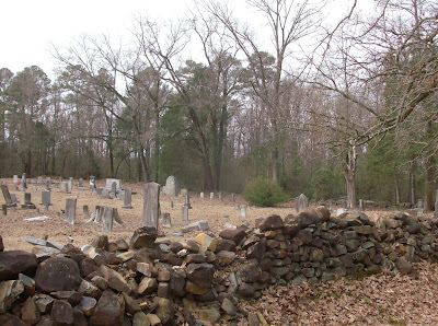 |
| Cememtery at Concord Baptist Church in Anson County where Griffin Nash and others are buried. |
Dec 16, 1806 Gov. Nathaniel Alexander of Raleigh, NC to Solomon Cahoon, Grant 1987 100 acres granted. 69 acres on the waters of Rocky River, begins at his second corner stak, joins Morris, Phillip Lynch, branch & Ramsey. Nat Alexander and Will White, secretary.
* Phillip Lynch....remember that name.
Nov 2, 1807 William Lanier of Anson to Edward Winfield of Anson 350 acres in 4 tracts: 100 acre border begins at a white oak at mouth of a gut on South side of Lane's creek, joins Robet Lee's back line; part of a grant to Robert Lee and willed to John Lee; 100 acres on the South side of Lane's Creek, begins at Richard Yarbrough's corner pine & joins Robert Lee; 50 acres border, begins at Robert Lee deceased's second corner, joins Humphrey Yarbrough's old survery on "the" creek & John Ramsey's beginning. & 100 acres border begins at his old corner stake and joins Edward Winfield. Signed William Lanier, Witnesss: Frederick Staton, Robert Lee & Frances Lee (female).

1815 Isaac Abercrombie, Edward Winfield, C Coppedge, John Grady & Josiah Allen, commissioners appointed by Anson Co court to divide real estate of Phillip Lynch, deceased: 1 lot about 50 acres to Nancy Lynch, border joins Job Davis & Thomas Avett (Note 1). Lot 2 about 50 acres to Sally Cawton, joins Griffin Nash & Thomas Avett (Note 2). Lot 3 250 acres to Green Lynch joins Griffin Nash & Varhaian (Note 3). Lot 4 100 acres to Caty Lynch, joins Isaac Abercrombie called "Sanders old field"( *Note 4). Lot 5, 36 acres to John Lynch, joins William Marshall and Rocky River. Lot 6, 48 acres to Betsy Lynch, joins Rocky River. Elizabeth Lynch and John Lynch valued at $194. Isaac Abercrombie, Edward Winfield, Charles Coppedge, John Grady & Josiah Allen, July 1816 division returned to court & recorderd Book R, p 279.
The above deed is a genealogy researchers dreams. It names all of the children of Phillip Lynch in one document, in 1815! John Ramsey is not mentioned, but nearly all of his neighbors are, and Charles Coppedge, to whom he sold 135 acres of the 150 acres he had bought from John McIlvale.
Note 1: Previously mentioned in this area bordering Phillip Lynch was Joshua Davis and his wife Hannah. Now it's my ancestor, Job Davis, who this blog is named for. Was there a connection between Joshua Davis and Job Davis? Possibly, I've been looking into it. But Job Davis married Sarah Winfield, daughter of Peter Winfield. Thomas Avett was also a son-in-law of Peter Winfield. He was the second husband of Ancena Winfield. Her first was James Morrison. The first husband of Sarah Winfield was Richard Howell.
Note 2: Griffin Nash was also a son-in-law of Peter Winfield, having married his daughter Jemima Winfield. Here Griffin Nash's property joins that of Thomas Avett and Phillip Lynch. Thomas and Ancena would later migrate to Tennessee. But with the addition of Edward Winfield in the mix, it clearly appears the property of Phillip Lynch adjoined that of what had been the plantation of Peter Winfield, which had been divided between his 4 children: Edward Winfield, Jemima Winfield Nash, Ancena Winfield Morrison Avett and Sarah Winfield Howell Davis.
Note 3: This was Everette, or Ernert Verhine -victim of various spellings, not sure where he came from but they certainly had a hard time with his name.
Noter 4: Sanders old field. This was mentioned in deeds in which Stark Ramsey participated. He had a son named Sanders. Could this name have derived in some way from the Sanders who had owned this field? So many questions. No answers.

Feb 22 1816 Solomon Cahoon of Anson to Godfrey Burnett of same, 3 tracts. 150 acres on both sides of Little Creek, begins at a red oak on the banks of Rocky River and crosses the creek, includes the improvements; 67 acres, border begins at his second corner stake, joins Morrison, Phillip Lynch, a branch & Ramsey; 50 acres, begins at Edward Winfield's corner red oak in Ramsey's line, joins the river & McLendon. signed Solomon Cahoon. Witnesses: Edward Winfield and John Forrest.
Recall Morrison was the name of Ancena Winfield's firs husband, and she had already remarried Thomas Avett by this time, so this may have been her son's property. Edward Winfield's property obviously bordered "Ramsey's". John Ramsey is the name mentioned in these properties, but Stark Ramsey is the only Ramsey showing up on tax lists and in census records by this time.
March 12, 1822 John Watson of Marlborough District, SC to Burwell Braswell of Anson, 100 acres on the East side of Little Creek, begins at John Ramsey's corner post oak, joins 'A crombie' & Lynch' except the exclusive right of the Watson family using water out of a certain spring on said land' granted Dec 19, 1803 to John Watson. Witnesses: Armistead Lilly & John Grace.
The land on Little Creek is still being identified as belonging to John Ramsey. A crombie is no doubt Isaac Abercrombie and Lynch, the Lynch family land obviously. This is 1822. Is John dead and the land just stagnantly remaining in his name?
July 11, 1828 Absalom Myers, high sheriff of Anson to William T Caraway of same, 100 acres on the East side of Little Creek. Border begins at John Ramsey's corner post oak, joins Abercrombie & John Ramsey, granted December 19, 1803 (*Note 1) to (Omitted) sold March 10, 1828 due to an execution from Anson County Court against Burrell Braswell for $125 principal & 16.25 interest & $9.55 costs due to suit by John Watson of Anson Co; land sold because no goods or chattels found.
Signed A. Myers, Sheriff. Witnesses: W Hammond and M D Watkins.
Note: This is the date on the Starky Ramsey Grant above.
July 14, 1829 William T. Caraway of Anson to John Beard of same, 10 acres on the East side of Little Creek begins at John Ramsey's post oak, joins "Crumby"; granted Dec 19, 1803 to (omitted). Signed W T Caraway.Witnesses: James Horn and Tom Taylor.
This is the same tract of land he bought a year prior. Could this be Stark Ramsey's 1803 grant?
Nov 16, 1841William Lee Jr. of Anson to Young Allen of same, Lee owes $50 to Joseph Medley by note; to secure payment & for $1 paid in trust (a) 50.75 on waters of Little Creek, Border begins at John Ramsey's corner post oak, joins Abercromby, a road and Bryant Braswell....(names farm animals) Signed Willim Lee, witnessed by Bryant Braswell.
Now, this is beginning to get silly. It's 1841 and John Ramsey has not appeared in a census record since 1790, nor any tax records.
Oct 4, 1842 Griffin Nash of Anson County to John S. Kendall of sam, 200 acres on waters of Austins Branch, begins at said Kendalls corner dead hickory and joins Howell (*Note 1), being lot laid off to Nancy Nash (*Note 2) in division of land of Phillip Lynch deceased. Signed Griffin Nash, Witness: Allen Carpenter & James T. Kendall.
These names are getting very familiar. Griffin Nash was the son-in-law of Peter Winfield. Jemima Winfield Nash had died young.
Note 1 Howell referred to Peter Howell, oldest son of Sarah Winfield and Richard Howell. Job Davis and Sarah Winfield Howell Davis had transferred this land to Peter when he was just a boy.
Note 2 This would be Nancy Lynch in the above Lynch land division. It appears that she was the second wife of Griffin Nash! I never knew he remarried, and I was familiar with Nancy Nash and she and her son George will get posts of their own. She is living next to Stark Ramsey with Benjamin Hutson in Burnsville in the 1850 census. This was not a Ramsey, but Stark lived next to them.
Aug 17. 1842 Joseph White, High Sheriff of Anson County to David C. Lilly of same. 51.75 on waters of Little Creek, begins at John Ramsey's corner post oak, joins Abercrombie, E M Sibley, a road and Bryant Braswelll & William Lee. Signed J White, Sheriff. Witnesses: William Allen and John Rogers.
This is the last deed that mentions John Ramsey.

Odd and odder. Starky Ramsey had 3 Land Grants but never bought or sold land. He only appeared in deeds as a witness.
Then it hit me, What if Stark Ramsey was John Ramsey. What if his name was actually John Starkey Ramsey, and like Griffin Nash, he went by his middle (or less common) name in most records?
Not the original John Ramsey of the late 1700's and the 1790 census. Not the John his land adjoined. But maybe that John Ramsey (his father? his brother?) died or migrated away, and the Ramsey on Little Creek was actually Stark?
I had originally not found John Ramsey's Grant, but in a book on Anson County records I found a list of Anson Grants.
John Ramsey, Grant #3633 - 25 July 1774 - Lane's Creek.
As John does not appear in any petitions prior to this date. This may be time of his arrival in Anson.
Where did he come from? And where did he go? Who exactly was John Ramsey?
No comments:
Post a Comment