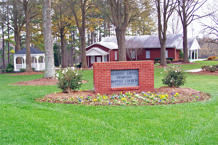
Showing posts with label Bear Creek. Show all posts

Thursday, April 13, 2023

Where was Boston's Branch?


Location! Location! Location!
The mantra for real estate agents worldwide has implications in  genealogy circles,too.

I recall when I was in the D.A.R., an individual attempting to prove her lineage using decendancy of land records and proof of bordering properties in a case of the lack of a Will, or estate records to prove the connection between generations. Simply put, would they accept the fact that these individuals of the same generation who owned adjoining properties and had the same Surname, qualify as proof that they had inherited it as heirs at law of the man of an older generation who  lived there prior?

I don't know if her submitted application and the hard work she had done to provide proof, or whatever ragged shards of it remained, was accepted, but it was suffice for this descendant to know who 'her people' were. 

In the case of Isham Robbins, who shows up suddenly in the first tax list of Stanly County, North Carolina, dated 1841, as owning 150 acres on Cucumber Creek, without even a trace of him before, I wondered if there could be a link in the descendacy of the land that would tie him to the Robbins family who had dwelled there decades earlier?

Isham Robbins isn't in the 1840 census of Montgomery County, North Carolina, the parent county of Stanly. Neither is his son, Solomon Franklin Robbins, despite being active in the earliest court records just a year or so later. There is no grant or deed showing how the land he was taxed for came into his hands. So my thoughts turn to the possibility of it having had been inherited, and as the Montgomery County Courthouse was known to have been the victim of arsonists several times over, any records could have, and probably had been, destroyed.

Isham Robbins estate was settled in 1843, a mere two years after he was taxed, by his widow, Frances Caroline Whitley Robbins and John Honeycutt, who was in the least, her neighbor. Two years after that, John Honeycutt was taxed for 300 acres on Stony Run Creek. Solomon Robbins also owned land on Stony Run Creek, but Fanny's property was said to be located on Bear Creek. Cucumber Creek, which still holds the same name all of these 180 years later, was located primarily in the same township, but in a different location than those two. Was the property inherited from Fanny's Whitley family,  or could they have been inherited from the earlier Robbins? 


I began searching old maps. The history room at our local museum has an excellent collection of maps. Among them were two, where a team of local historians, some years ago, had begun mapping early land grants and naming landmarks. I zeroed in on this location shown above. Little Bear Creek flows from north to south down the middle of the screen. To its east is Long Creek and southeast Little Creek. Midways near the middle of the map is Saint Martins Church. Saint Martin's Church is a Lutheran congregation that was established in the early 1820's, beginning with meetings held at the home of the Swiss Jacob Efird (Efrect or Eoforheard). Just to the left of where 'St. Martin' is labeled, you see "Exodus" for Exodus Whitley. Exodus Whitley also owned property across the Rocky River in Anson County on Richardson's Creek, which bordered that of old John Robbins. The Creek that rises north from his name is Big Bear Creek. West of the name of Exodus Whitley is Stony Run Creek. Traveling up Big Bear from Exodus Whitley's grant, crossing Hwy 24/27 is another stream, or two. The stream to the west of Big Bear shows George Whitley's grant and is called Whitley's Branch and the stream to the east of Bear is called Ramsey's Creek, or "Big Branch". Although my ancestor, Samuel Ramsey lived near, and is buried at, Saint Martin's, I believe that stream was probably named for William Ramsey, who lived early in this area. 


I keep running into my Ramsey relatives while researching my Faulkner lines, and now, by digging into the Robbins. I've never attempted to find out anything about William Ramsey, early Stanly County settler, and kept my eyes on Anson, and a little bit into Richmond Counties. This is neglectful on my part, especially since Samuel Ramsey's father, Starkey Ramsey, is another one of my brickwalls, and really didn't live far south of the Rocky River. The only clue was on one of his land grants, his property bordered that of a John Ramsey. John Ramsey was older, and shows up in the 1790 census of Anson, when Stark doesn't show up until 1800. There were a few other Ramsey's that showed up in those early years, including a Samuel Ramsey, before his son, Samuel was born. Stark, and his children, were the only ones who remained in the area. The rest disappear, probably having migrated on, south or west, as was the trend in those days. 


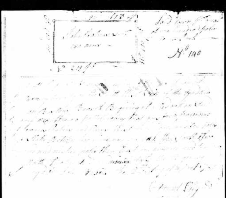
On March 2, 1780, John Robins recieved a 150 acre Grant, Warrant 140, issued by Benjamin Baird, on the SW side of the Yadkin River and on Boston's Branch. The border began at a Red Oak along the branch near where a path crosses "from Parmours towards Robins'. It was surveyed 5 years later, 1785, by Edmund Lilly. William Ramsey, whom I just mentioned, and John Robbins, Jr. were chain carriers. John Jr. would have been in his teens at this point. The grant, pictured below, is difficult to read, #342, issued August 9, 1786.


In all honesty, there were not that many grants given for Boston's Branch. It must have been a small stream. The other one dated 1780 was that of William Baird, for 200 acres, Warrant 292 issued on June 26, by Benjamin Baird to William Baird on Boston's Branch on the Waters of Long Creek and includes Andrew Bankston's or John Kelly's improvement. It was surveyed in 1785 by Mark Allen, on the SW side of  the Yadkin River between Deep Creek and Long Creek and began at  a pine on Parmer's line. Zachariah Hogon and Mark Allen were chain carriers. Grant 422 issued Nov. 26, 1789

There's that name, 'Parmer" or 'Parmour' again, as well as Baird. Another intestesting thing is the part where it includes the improvements of Andrew Bankston or John Kelly. John Robbins Sr. must have gotten anscious after  his young son, John Jr. was drafted into service during the Revolutionary War, and hired a substitute named William Bankston to take his place. My bets would be that William Bankston was related somehow to the above mentioned Andrew Bankston. This was a family that did not remain in the area. A quick search of just Land Grants shows grants being in 1779, the year Montgomery was cut from Anson, and the names of Jacob, Lawrence, Daniel and Andrew Bankston, with Andrew recieving a whopping 5 grants, all located in what would become Stanly County. Switch the search to Anson and I found 5 more for Andrew, beginning in 1775, all on the West Side of the Yadkin, the first on the east side of the Long Branch of theYadkin River, two on the Middle Fork of Mountain Creek and two on Deep Creek, which is in modern Anson. 


Another interesting deed, not on Boston Branch, but included here because of the date, was a 150 acre grant received of Henry 'Munger' (Mounger) in 1782 on the Northeast side of Bear Creek, and includes a springhead at the head of Little Creek, beginning at a pine, whereinThomas Reynolds and John Robins were chain carriers. This must have been John Jr. as John Sr. was declared an invalid in the 1782 tax records. 

Inspecting a terrain map, Little Creek seems to be born off the runoff from a ridge to the east of Tyson Road and begins near Western Road, fed by hills along the side of it. Henry Mounger, like Benjamin Baird, was an early land prospector. He was continually cutting grants from his larger tracts.


Next up, on Christmas Eve, 1785 was Hezekiah Dollarhide,shown above,recieving a 100 acre grant from John Crump on Boston's Branch of Long Creek and included 'young John Robbins improvement'. Grant 403 was issued on August 7, 1787 and John Pamer and Edmund Lilly, Jr. were chain carriers. It appears John Jr. was clearing and cultivating this land before Hezekiah Dollarhide recieved the grant. 

Two years later, in 1787, Hezekiah Dollarhide recieved a second grant, to property on Little River in Randolph County, NC, as an assignee of John Knight.  There were two Hezekiah Dollarhides, one born in 1745 and the other in 1783. This would have had to be Hezekiah Sr. The family left Randolph County before 1820 and settled in Wayne County, Indiana. He died there after 1830.


Hezekiah Dollarhide
Home in 1820 (City, County, State)Wayne, Indiana
Enumeration DateAugust 7, 1820
Free White Persons - Males - 45 and over1
Free White Persons - Females - 16 thru 251
Free White Persons - Females - 45 and over1
Number of Persons - Engaged in Agriculture1
Free White Persons - Over 252
Total Free White Persons3
Total All Persons - White, Slaves, Colored, Other3


When John Robbins Jr. stated in his pension application that he had lived in Indiana for awhile after his service, I wondered if that had had anything to do with Hezekiah Dollarhide, or if he had travelled with him. 


Then came the Smiths. On October 3, 1800, warrant 5391 was issued by John Neal to "Sherrid" Smith for 150 acres that began at Sherrod Smiths (also seen as Sherwood) own corner tree on Boston's Branch of Long Creek, surveyed on May 4, 1801 by Thomas Cotton. It was on the southwest side of the Yadkin River, on Bostons' Branch of Long Creek, and joined the property of Asa Smith, 'near' Castle. Sherrod and Asa Smith were the chain carriers. It then stated that on November 24, 1801 Sherrod Smith paid purchase money for 150 acres in entry #5391, signed by the comptroller, grant 1785. 


The very next grant, No 5392, was to the aforementioned Asa Smith. While his property was not on Boston Branch, I've included it because he had property that bordered that of Sherrod Smith that was on Boston's Branch.
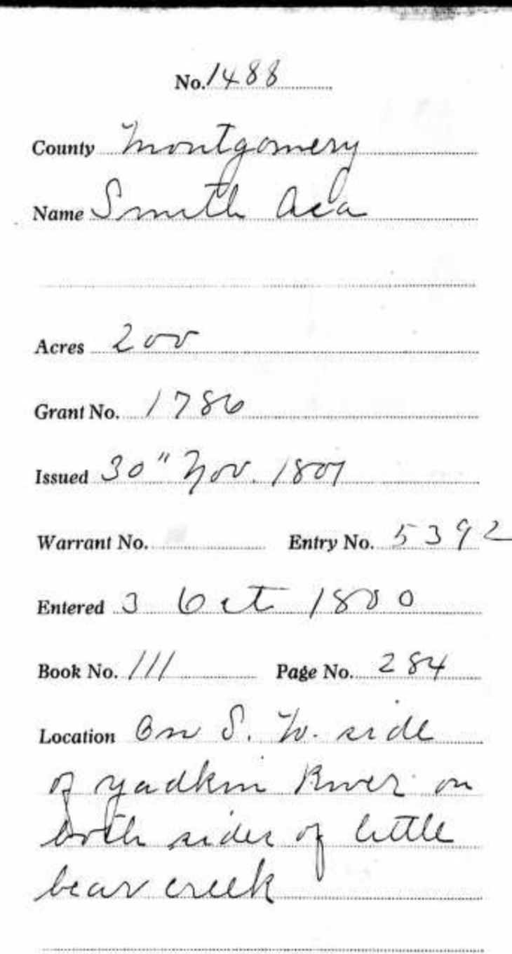

Asa Smith recieved a grant for 200 acres on each side of "Bear" Creek, that was SW of the Yadkin River and on both sides of Little Bear Creek bordering a post oak in his own 100 acre tract. Richard Green and Sherrod Smith were chain carriers.


I kept looking for a spot where a branch off off Long Creek might lend itself to allowing joinng properties close enough to touch a 150 acres property that straddled Little Bear Creek. 


Asa Smith owned several properties. The below deed has an interesting northern border that looks very difficult to plat. This was the one that straddled Little Bear Creek.


But we're not done with the Smiths, oh no! 

In 1814, Phillip Smith received a warrant of 100 acres, issued on June 8 by Will Stone, on the waters of Long Creek, on Boston's Branch, joining the lands of Sherrod Smith and Andrew Bankston, Surveyed in 1814 by David Cochran on the waters of  Long Creek, the border beginning at a pine in 'Sharwood' Smith's line, joined Phillips own line and that of Lloyd Rowland. Sherwood and Phillip Smith were chain carriers. 

Boston's branch was becoming a regular little Smithville. 


And above is Phillip Smiths plat of land, a simple rectangle with an anchor. I am not able to tell which side of it was on Boston's Branch, and where it met the property of Sherwood Smith or Andrew Bankston. My best guess would be that 'toe' was sticking in the creek. 


Then below, we have Sherwood Smith's land on Bear Creek, meeting Whitfields line and was 50 yards east of Little Bear Creek It also met the property of William Capel and William Capel and 'Sherwood' Smith were the chain carriers
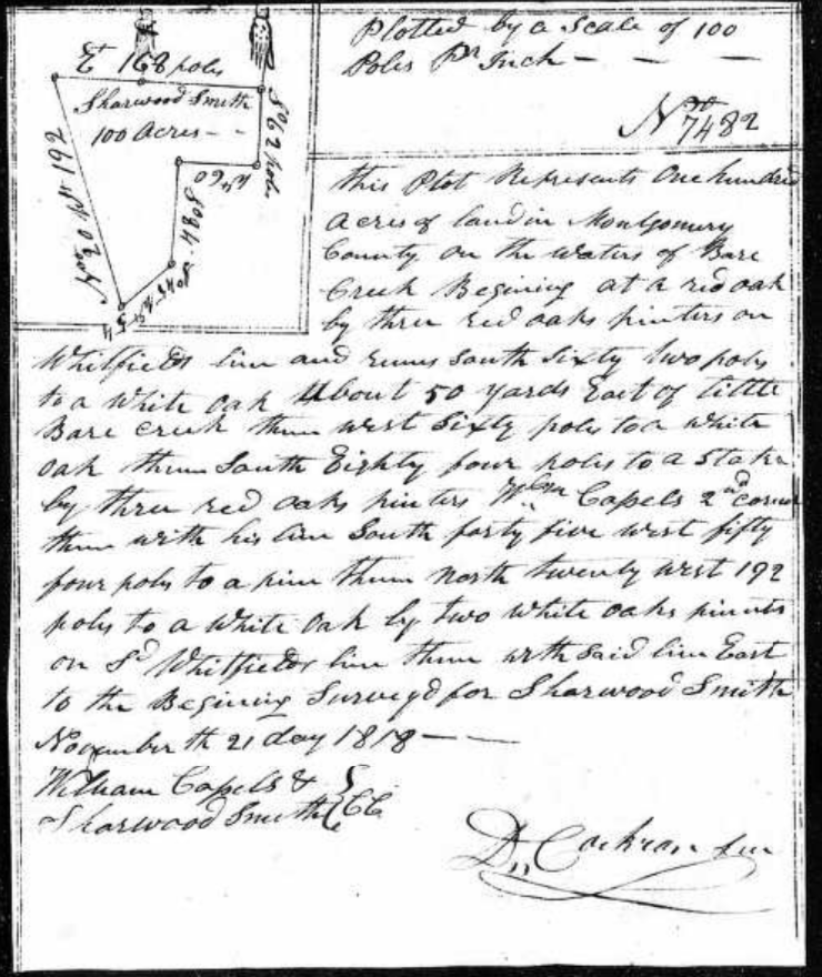


I keep coming back to this area of the county, and these creeks and roads, flipping them one way or another, and looking at the current county GIS maps to see if any shapes look familiar. As of yet, this puzzle remains scattered on the table in so many pieces. 


Asa Smith owned another tract which bordered the property of Brittain Chappel. I begin to notice that some of these mulitiple tracts to the same individuals were not that close together. This wasn't a small farmer adding to his already owned property widen his purvey, this seemed more like an investor, grabbing up property, perhaps as people moved on, and maybe capitalizing by renting it out, but they certainily were not driving that oxteam up a dirt road for 10 miles every day to plow their second field. 


Asa Smiths grant that neighbored Brittain Chappel named Elijah and David Smith as chain carriers. This was certainly a family venture. 


The Smiths seemed to have a bit of an enclave on, or near, Bostons Branch, so it is time to take a close look at who they were.

Asa Smith was counted in the 1790, 1800 and 1810 census records of Montgomery County, North Carolina.
He recieved several land grants in Montgomery County. The first, Grant Number 1786, in 1801, was located on the Southwest side of the Yadkin River, on both sides of Little Bear Creek. This grant of 200 acres included Sherrod Smith and Richard Green as chain carriers.

His second grant, shown above. 7629, dated 1817, joined the property of Brittain Chappel, joined his own property on Long Creek.

His third grant, Number 2529, Dated December 5, 1818, was on the waters of Long Creek. Elijah and David Smith were chain carriers. 

Asa may have removed to Tennesee. I can not be certain. I am also not certain of his relationship with Sherrod, or Sherwood Smith, but the chances are pretty good that they were related in some way, the most likely being brothers, as they were not parent/child. This is just a possibility.

Sherwood or Sherrod Smith, is a little better known. He was born in Viriginia and was also in Montgomery County, North Carolina by the 1790 census, but did not stay here. He married his wife, Faith "Faithy" Holmes in Mecklenburg County, Virginia on December 21, 1786. By 1830, he was in Carroll County, Tennesee and he is in Willamson County, Tennesee in 1840 and 1850. He was also on the 1816 petition concerning the county courthouse location, along with his sons, Phillip and Sherwood Jr. 


Will of Sherwood Smith


Sherwood Smith died in Williamson County, Tennessee in 1851 and left a will., menitioning two of his sons living in Illinois. One of them was Phillip.


NamePhilip Smith
GenderMale
Birth Date1780
Birth PlaceMontgomery County, North Carolina, United States of Jo
Death Date14 Sep 1860
Death PlaceBlueville, Christian County, Illinois, United States of America
CemeteryTaylor Cemetery
Burial or Cremation PlaceRiverton, Sangamon County, Illinois, United States of America
Has Bio?N
SpouseNancy Smith
ChildrenNancy Ann WestIrvin Milton SmithLevi SmithEphraim SmithTilman SmithPhilip Smith


Phillip Smith was the oldest son of  Sherrod Smith. He was born in Montgomery County, North Carolina in 1780 and married Nancy Cooper, daughter of John and Elizabeth Carter Cooper. He first shows up in the 1810 census of Montgomery County, on the West Side of the Pee Dee River and recieves his grant on Boston's Branch of Long Creek in 1814. By 1820, he was in Sangamo, Madison County, Illinois, where he chose to raise his family.  He died there in 1860.


In 1810, however, the Smiths were in Montgomery County, North Carolina. The above list is the census page that Sherwood, Asa and Phillip Smith all appear on. The complete list is a little difficult to read in spots and since I am familiar with most of these names, I will retype it here:

James Casles (Cassels/ Castles)
Sherwood Smith (also seen as Sherrod)
David Rowland
Asa Smith
Richard Greene (Chain Carrier mentioned in Asa's grant)
Daniel McLester
Andrew Bankston (also mentioned in several of the above deeds. Land bordered Smith land on Boston's branch)
John Palmer  (see * note below. Very important)
Robert Stokes
Ambrose Stokes
Allen Stokes
James Coleman
Phillip Smith (son of Sherwood, on Bostons' Branch)
Henry Carter
Samuel Mann
Henry Mann
Solomon Holt
Malachi Mann
Richard Stokes, or Stoker

I thought WOW!, I know these people! No, I don't literally know them. I'm not that old. I am familiar with these names having came across them in prior research adventures. How's that?

*Note: Now I know who "John Parmer" or "Parmour" was, the dude with the path. Palmer, not Parmer. Not only do I know him, somewhere in my dna are pieces that John Palmer shared. He's my 5th Great Grandfather. John Palmer (1746- 1817)  was born in Maryland and the son of Thomas Palmer and Susanna Hunt. The Palmers were a very, very old New England family.  He married Janice Tamer and settled along the upper part of Long Creek in what is now Stanly County, and was then, Montgomery. Henry Davis, son of Job Davis, whom this blog is named for, married Martha Palmer, a granddaughter of John Palmer, as his second wife, and became my third Great Grandparents. This was at the inception of the new county of Stanly and Henry had moved from the Rocky River and purchased land on Cloverfork Creek, to be closer to his business in helping found the infant town of Albemarle.

James and Martha Atkins Palmer


I don't know exactly where John Palmer lived, but I do know exactly where his son James Palmer and wife, Patsy Atkins Palmer lived, and where Martha Palmer Davis had grown up. I also know the general location of where the Holts and Manns, listed at the bottom of the page, lived. 

Now, census takers used a methodology of taking count that I am not familiar with, but I do know they didn't count one family, and then ride 15 miles in another direction to count the next. The people listed were centrically located near enough to each other. Given, the population was sparse and neighbors could be far more than " hollering distance" away. Still, the neighborhood is suggesting a location more along the northern part of  Long Creek, an entirely different location than I was looking at. 

Could Boston Branch have been, literally, in my own backyard?


Plats assembled by George Thomas


I have a distant cousin on the Burris side who has an inate talent for assembling these little snippets of plats, and had already some of the Smiths.  Now we have a visual of  where Phillip Smith's  little point of land belonged.

Now I have new names to cut out and stare at like so many pieces of a jigsaw, and try to place them on a map.


And we are back to John Robbins barely visible grant on Boston's Branch. While in Anson County, I can find mention of properties adjoining that of John Robbins into the 1830's, long after I expect John Robbins Sr. was deceased, the latest mention of John Robbins, which I expect was John the Younger, in Montgomery County, was in 1814.


I will attempt to track his course from Montgomery County, North Carolina into Tennesee and Indiana and finally, to Spadra, Johnson County, Arkansas.


Which Branch was Boston's Branch and where did it go? Did it dry up and just disappear from record, or did it just gain a new name? Why was it called "Boston" in the first place? Did one of the early settlers upon it come from Boston? I keep looking at Gilberts Creek, shown on the left side of the map. In other deeds and records, the Robbins were very involved with a family of Gilberts, both in Montgomery County and in Anson. John Gilbert, Jesse Gilbert, Samson Gilbert, for the most part. I've found in other families that I've delved into that when two families seem particularly intwined and involved in one anothers business, that they are in fact, one family, intermarried and connected, usually, generationally, sometimes in several ways. 
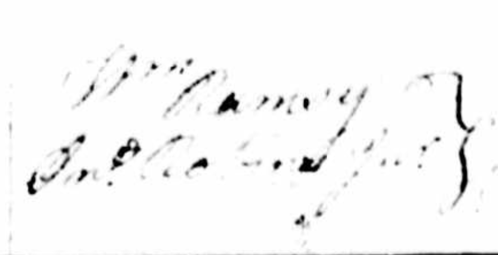

William Ramsey is another man I want to look into. Maybe, just maybe, there was a connection to Stark or to John Ramsey the elder, (as Starkey had a son named John). Another little tidbit, is that signature of John the Younger, (and of even a younger John Robbins who appears to be John III) as Jno (squiggly) Robbins Jr. The squiggly is not a J, as it looks nothing like a J. I believe it might be an I.


The location of Boston' branch has not been acertained. I'm tossing this missive into the metasphere to see if anyone out there has any more information about it. Was it renamed, or did it dry up due to changes in the environment? Was it on the northern end or southern end of Long Creek? Only just a handfull of men had grants located on it, so it must have been a small, short branch. The only thing I am sure of, Boston Branch was nowhere near Cucumber Creek.

When the jigsaw is assembled, I will be back. I will be looking at those men in the 1810 census located nearest to the known occupants along Boston Branch. Until then, I'm going to Clarksville.


Sunday, December 9, 2018

Early Land Records of the Stanly County Lamberts

What tales do the land records tell?

To some people, the old 19th century script and tree-killing legalese of old land records are hard to read and not relevant to their families' story. I find this quite the contrary. While learning to read ancient handwriting can prove to be a struggle, learnig that "f's" were often "s's" and chains, walnut trees, branches, springs, corners and lines can sometimes be the only link from one family member to another. Did they live side by side and have the same neighbors? Did the property pass from one generation to another? Did they witness each other's deeds and sign each others bonds? I've found a wealth of knowledge in land transactions.


I've not found one single deed in the Montgomery County records, which covered the area that is now Stanly, with the name "Lambert" on it, but sometime, somehow, before Stanly County was born in 1841, Rev. John Lambert had acquired 66 acres in what became Stanly County, somehow and from someone. It could be that the deeds were lost in one of the Montgomery County Courthouse fires, or were just never ratified.

The Lamberts settled on both sides of the Furr Township and Almond Township border. By the time this map came out about 60 years later, they were so numerous the community was called "Lambert". Notice all of the Lamberts on the above map. Many of the Almonds and McLure's were also grandchildren of Rev. John Lambert as one of his daughters married an Almond and a granddaughter married a McLure.


This old map pinpoints the location of J. T. Coley's Store. A road still bears the name, "Coley's Store Road". Two Lambert family cemeteries, one holding the remains of Rev. John Lambert and his granddaughter, Lavina Almond McLure, probably his wife Phida, and around 30 other family members are centered around the intersection of Coley's Store Road and Ridgecrest Road. This was more than likely the location of the old homestead of Rev. John.


The oldest Lambert deed in the Stanly County records, dated 1839, two years before Stanly was Stanly,  proves there were Lambert land transactions in "Montgomery", but what happened to them, I don't know. It was between Frederick Lambert and his brother Nathan. November 13th, 1839 Frederick Lambert of Montgomery County sold to Nathan Lambert of the same, for $110, property on Big Running Creek that intersected John Lambert's corner and ran with Martin Widenhouse's line. It was proved by John Lambert, Jr. in 1854

Frederick was on the move. He had showed up in Montgomery in the 1830 census, and had showed up in court records of Cabarrus in 1825 when they sent the sheriff to Montgomery County to fetch him, but the sheriff failed and was fined. He would show up in the records of Tishomingo County, Mississippi by 1842, when he was elected Treasurer of the County and applied for a license, along with a William Rushing, to open a tavern. It seems in those few years, 1839 to 1842, he had made that long journey, by horse and buggy and had well established himself in the community. Worth noting is that in 1844, his father, Rev. John Lambert, would build the Liberty Hill Church in conjunction with another William Rushing.


Image result for damage to Mississippi during civil war
Mississippi war destruction

Frederick filed several denied claims with the U. S. Southern Claims Commission. This was an agency set up to reimburse Union sympathizers who had lived in the Southern States during the Civil War for damages and losses they had suffered during the war. Frederick made several interesting statements in his depostitions. One that caught my eye involved the time he was still in North Carolina.

"In nullification times I lived on the border of South Carolina. It was publically declared that the man who dared to vote for Jackson should be flogged. Before 100 men I showed my ticket and cast my vote for Jackson. A few others followed me. If you want to know, I'm not afraid of 1000 men, I'm afraid of doing wrong".

The nullificaton period he spoke of occured during 1832-1833, during the Jackson Administration. South Carolina had declared that the Federal Tariffs of 1828 and 1832 were unconstitutional and therefore null and void in their state. This period began the doctrine of the assertion of states rights that would lead eventually to other acts and decrees that eventually led to war.

Frederick was in Stanly County, North Carolina at this time and the election he spoke of was probably the one of 1828. It's worth noting that John Lambert, nor any of his sons, ever owned slaves. A few of his grandsons did serve in the Confederate Army, whether by choice or by force, is a different matter that I will explore later. Frederick was a devout Republican and I am led to believe his father and brothers were as well. There were John Lamberts in Randolph and Chatham who owned large properties and many slaves. They were not our John. He was a Circuit riding minister who remained poor as a church mouse. He stored up his riches in heaven. Frederick, however, became a businessman and farmer and did well for himself. He suffered the loss of $5000 cash and many horses and other livestock during the War, for use of the Union Army.


The above section of map shows the location of Pole Bridge Creek and Running Creek

In 1844, George Washington Lambert was the one on the move. In 1841, he had been taxed for 105 acres. On March 1st, 1844, he sold to his brother Nathan, both of Stanly County, for $50.00, 154 acres

"on the head waters of Big Running Creek". 

T. A. White and Susan White were witnesses. On the same day, March 1st, 1844, for $25, he sold to John Lambert (probably his brother John, not his father John), 87 acres on the headwaters of Big Running Creek.

George W. Lambert relocated to Iredell County, NC. He married Jane "Jennie" Page, a sister to John Calvin Page who married his sister Piety. He probably relocated with Burwell Pliler (Plyler), who was his neighbor in 1860. George and Jane had a large family, but did not profit much. They farmed, but did not own any land. He may have faired better to have stayed in Stanly County. There were already a few Lamberts there before he arrived and several descendants have tried to tack him to them, even suggesting he was one of them, but had changed his name. Fortunately, two of their sons who lived long enough to have death certificates, have them as being born in Stanly County on them, and dna has verified this is our George. Some current descendants go by Lamberth instead of Lambert.


Martin Widenhouse was a wealthy landowner in southeast Cabarrus County. His father, of the same name, was born in Germany. The following land transaction most likely involved Martin Jr. as I believe Martin Sr. died in the 1840's. The Widenhouse family settled thickly around the Midland and Georgetown areas of  Cabarrus.

1850 Martin Widenhouse of Cabarrus County to John Lambert of Stanly County for $90, 120 acres on Pole Bridge Creek. It adjoined John Lambert "and others". There was one exclusion, Martin kept claim on "one half of the gold and silver mines". Nathan Lambert was a witness. The property was fairly close to Reed's Gold mine.

Also in 1850, Jonathan Lambert sold to William Lambert for $5.00 104 acres that bordered a line William Lambert owned already, on the "waters of Stony Run".


Image result for stony run creek, stanly county
Stony Run Creek


This William Lambert was the son of John Jr., and was also known as "Buck" Lambert. He was my direct ancestor. He was born in 1824 and married Talitha Herrin, a daughter of Hezekiah Herrin, who was mentioned in the dockets of Bear Creek Church and who was the patiarch of the Herrin family and community for which the Herrin School, shown on these map snippets, was named for. His uncle William, the oldest son of Rev. John was living in Cumberland County at this time.

Jonathan was but a few years older than Buck. There's been speculation on whether he was a son of Rev. John Lambert or John Jr. These old 19th century farm families began having children from marriage to when the mothers were in their 40's. Many children did not make it to adulthood due to plagues and diseases, ailments that are treatable now, fires and accidents, even wild animals. There were bear and buffalo in this area when the first settlers arrived, hence the names "Bear Creek" and "Buffalo Creek".  I've read numerous sad old stories about toddlers falling off horses, or little girls catching their skirts on fire by playing too close to the hearth, or even babies placed on pallets while the mothers tended garden nearby, being taken by hawks or other predators such as wolves or wildcats, not to mention the bouts of thyphoid, TB or influenza that would wipe out half the family.


Phida would have been 21 upon the birth of Rebecca in 1795 and well into her 40's by the birth of Jonathan, but I'm siding with the theory of Jonathan being Rev. John and Piety's due to 2 factors. One, he was living with them in 1850, and two, John Jr. outlived Jonathan and left a will. In the will, he mentions his orphaned grandchildren, but not the children of Jonathan.

Image result for herrin's grove primitive baptist church


In Book 3 Page 91  Hezekiah Herrin sells to Talitha Lambert (his daughter), for $100, 164 acres on the waters of Stony Run and Jordan's Branch, " on the south side of the old road near Lambert's line". 

WB Herrin and Green D. Whitley were witnesses.

In Book 3 Page 362, in 1851, Robert Motley and others to Nathan Lambert, a very interesting deed is found. This would be the younger Nathan, son of John Jr., as the older Nathan, son of Rev. John, had migrated to Marion County, Illinois by then. The 1839 deed would have been Nathan the 1st, son of Rev. John, as Nathan the younger would have been too young at the time. Robert, Ransom and Thomas Motley (Jr.) by their agent "N. Barringer", of Cabarrus County, sold 5 tracts of 100 acres that had been sold by Anthony Williams to Thomas Motley, Sr. on the north side of the Public Road. "30 acres one part sold to John Lambert Sr. for metes and bounds of the original tract reference made to the deed from Hellums to Motley and other tract on waters of Running Creek, John Lamberts corner, then with his own and Thomas Motley's sons line and Hellums old line of 12 acres". 

It was signed by Ransom, Robert and Thomas Motley via their attorney. G. A. Whitley was a witness. As a note, the name "Hellum" was the original form of Helms, a large family centered in the Union County, Monroe area. There are plenty of Helms in Stanly County. I descend from a Tillman Helms who married Mary Elizabeth Preslar or Presley. They were some of my 5th Great Grandparents. Her Grandfather, Andreas (or Andrew) Preslar immigrated from Rheinland-Pfalz, Germany, via New York and Massachusetts and settled on the Rocky River in what was then Anson County. The name stayed Preslar in some lines and was "countrified" to Presley in others, just as Hellums became Helms and in some lines who migrated west, remained Hellums. You may can guess that Andreas Preslar left one very famous descendant among members of the family who migrated from right here on the banks of the Rocky River, to Tennesee. Yes, it was with great pleasure, that before her death, I was able to inform my mother, thanks to Ancestry.com, that she was indeed, a 10th cousin to her idol, the infamous Elvis Presley, the king of Rock and Roll.


Image result for elvis presley heritage
Elvis Presley as a child.


These cycle of deeds continues when on July 27, 1851, William Lambert sells to John  Lambert, for $50, 154 acres on Big Running Creek, near the forks with Little Running Creek. It was signed by William and witnessed by William Stancell and Nathan Lambert. Was this the same 154 acres sold by George Washington Lambert to Nathan Lambert I in 1844?

This was found in Book 3, Page 372. The very next page, 373 contained the following deed: March 1, 1852, Nathan Lambert to John Lambert for $13, a 19 and a half acres tract on Running Creek bordering the Salisbury Road.  It was witnessed by William Lambert and J. H. Herrin.


Also in 1852 was a deed  concerning the Motley heirs and the Lambert family again.

September 7th, 1852, Thomas Motley to William Lambert  Book 16 Page 23

Ransom, Thomas and Robert Motley by their Agent, Attorney Barringer, of Cabarrus County, sold to "Will J Lambert" of Stanly County for $160, a tract of land referred to as "the old Drury Place" and "Motley's old field". It contained 310 acres and included a tract of 78 acres "hereforto claimed by Ransom Motley" , but "not to include 12 acres claimed by John Lambert (Sr.) and for which he  has a deed from Thomas Motley."   The tract was located on Running Creek "adjoining John Lambert and the Ruben Almond tract. It was signed by "Agent Rufus Barringer" and witnessed by Henry Plott and Henry Hinson.

The very next page, Book 16 Page 24 was a sale of this same tract, also in 1852, from William Lambert to John Lambert, described to lie on Running Creek and the Fayetteville Road (which later became known as Route 24/27). This deed was ratified on December 3, 1885 certified by a codicil by Thomas Lambert, Justice of the Peace and the witness signatures of John L and William Lambert.

This, and many of the following Lambert family deeds caught my attention for that one issue, the ratification of Thomas Lambert, Justice of the Peace.

Now a little bit about Thomas Lambert. Thomas was what I call a Ribbon. He kind of ties the whole family together. Many family trees have Thomas as a son of Rev. John and Phida, and given, he was basically the same age as Jonathan, but he was a grandson, not a son.


Image result for district 3, Johnston county, nc


I will go into more detail on Thomas later, but briefly, he was born on July 31, 1820 in Johnston County, NC. He married to Nancy Partin in 1842 in Wake County, NC which borders Johnston County and shows up with her in the 1850 census, in Johnston County, their first two children, Julia and James, and a 28 year old William Lambert. Thomas was a merchant and William was a clerk. I've found newspapers articles on merchandise arriving in Wilmington and Fayetteville, up the Cape Fear, for the store they obviously ran together.

Image result for district 3, Johnston county, nc


The Lamberts lived in the Pleasant Grove township, which was in the pointy western corner of Johnston County and bordered Wake and Harnett, explaining why some of their marriages took place in Wake County. By 1860, Thomas was living in Wilkes County, beside a William Anderson, who may have had something to do with him naming a son Anderson. In the meantime, his younger brother, William Henry had married Millie Ann Watkins and was a Teacher in Johnston County and started his own family. The Lambert sons were well educated. Willliam Henry was also a Justice of the Peace in Johnston County.

Their father, William Lambert, was the first son and second child of Rev. John Lambert. He first shows up on a tax list in Johnston County with John, marries Louisa Young, daugher of a Thomas Young, in Wake County in 1819, shows up in Wake County in the 1830 census, in Cumberland County in 1840 and 1850, and then by 1860, he's back in Johnston County with his second family, after marrying Charlotte in Cumberland. In 1870 and 1880, he's alone and living in the household of his son William Henry. He had 4 sons by Nancy and a son and daughter by Charlotte. His youngest son was called Needham. There seems to me to be a close connection to the Needham Whitley family which started in Johnston County and moved to Stanly County also.

Before 1870, Thomas Lambert joined his Aunts, Uncles and Cousins in Stanly County. And he blew in with a vengence.  He appears to have evaded the War, no record of his serving. As a Justice of the Peace, it appears he gathered up all of the Lambert family land deeds, had them ratified in 1881 with the testimony of any living witnesses or relative witnesses of signatures. He was looking out for his family. He lived close to them, on land occupied by Lamberts for decades and was buried with many of them at Bear Creek when he died just a few years later at the age of 67.


Portion of map showing Liberty Hill, Pleasant Grove, 'Five Points, Red Cross and the town of Big Lick.

Daniel Freeman was a merchant in the County Seat of Lawrenceville, before the division of Montgomery County. After, he moved his store to the fledgling town of Albemarle in the newly minted County of Stanly, that had previously been known as "Smith's Store".  Located at the junction of Little Long Creek and Town Creek with Big Long Creek upon the rolling hills of the Hearne Plantation. 50 acres had been cut off of the plantation for the town, and citizens all over the county came to the little spot on the hill to do trading  and take care of court business. Several got in debt with Mr. Freeman, whom I believe to have been a nephew of my ancestor, Charlotte Freeman Winfield. The Lamberts were no exception.

November 9, 1856 Book 6 Page 528 John Lambert took out an indenture on his property for $150 for debt to Daniel Freeman.

November 20th 1856 Book 6 Page 531, his son William Lambert did the same for $175 a tract that bordered Nathan Lambert's line, Tucker's corner, Jonathan Lambert's corner, William Lambert's line and Tucker's line.

Book 14 Page 526 Jonathan Lambert sold to Nathan Lambert for $50  50 acres along the Concord Road where Running Creek crosses the road at the mouth of Spring Branch along William Lambert's line "in the presence of John Lambert" in Superior Court.

Thomas Lambert, Justice of the Peace, ratified this deed on 14 December 1885 with William Lambert verifying the signature of John Lambert.


In 1869, William Harrison Huneycutt and wife Tabitha sold to Thomas Lambert 78 acres on Little Bear Creek for $250 adjoining Isaac Bailey and Susan Perry and a second tract at the head of Muscle Springs near "Dunn's old line".

Then just a little later in Book 7 Page 131 Thomas bought another tract of land on Little Bear Creek from Levi H. Mason and wife Mary A. Mason bordering Reading (Reddin)  Almond.

By the 1870's, the next generation was getting involved. In 1873, John L Lambert bought land on Stony Run Creek from William H. Carter adjoining Jonathan Lambert, witnessed by C. W (Caleb Wiley) Lambert and N R Lambert

Book 9 Page 599 Thomas Lambert recieved a grant in 1875 for 12 1/2 cents an acre to the Treasurer for a 5 1/2 acre tract "where Howell Burleyson's line crosses said Lamberts".

In 1876 William "Buck" Lambert sold 82 1/2 acres to Anderson and Thomas Lambert Jr., sons of his cousin Thomas, that bordered Ransom Almond and John Almond.

Another notable deed was that between Ervin and Ellen Almond to William "Buck" Lambert. Ervin Lambert was the son of Pleasant Almond by his mistress, Barbara, born while he was still married to Rev. John Lambert's oldest daughter, Rebecca. Ervin married Buck Lambert's sister, Piety and had several children before she passed away. Then he married Ellen, who had lived in several different counties before she married. Her family migrated to Lafayette County, Mississippi, as did Ervin and Piety's two older children in adulthood. This deed shows that Ervin also moved to Mississippi, but returned to Stanly County and is buried in the Lambert cemetery. Ellen might have divorced him, as she remained in Missisippi and remarried. The deed lists them as "Ervin and Ellen Almond of Abbeville, Lafayette County,MS to William Lambert of Stanly County, NC.


Map showing location of Bear Creek Primitive Baptist Church

On April 1862, Andrew Huneycutt, administer of Jonathan Lambert, sold to William J. Lambert, son of Jonathan, his father's land on the Concord Road, Witnessed by Eli M. Herrin, William Lambert (probably Buck) and ratified by Thomas Lambert, JP in December of 1885. Book 16 Page 140

Just two pages later, in Book 16 Page 142 there was another deed that sort of proves a point of mine. It's between John Lambert (Jr.) and his son John Quincy Lambert, for land on Big Running Creek. It was witnessed by Caleb Wiley Lambert and his father, William "Buck" Lambert. It was ratified by Thomas Lambert, JP by oath of  CW  Lambert. Two points here: One, John Quincy Lambert was John Quincy alone. John Jr was never seen as John Quincy. I see many trees with him having this middle name or either that of William. I've never seen Reverend John with a middle name, nor John Jr. The other point was that of Thomas ratifying all of the family deeds. 

The Lambert deeds get thick and varied among the Grandsons, Great Grandsons and Great Great Grandchildren of Rev. John Lambert of Liberty Hill. Despite being poor as a church mouse and getting behind on his taxes, the old Primitive Baptist Minister left a legacy, and more than a few secrets.